


Land id®
4.1431.00 Reviews
App Specs
- Version
- 5.44.0
- Updated On
- License
- Free
- Downloads
- 100,000+
- Developer
- Land id™
- Categories
- Productivity
- Platform
- Android
Screenshots
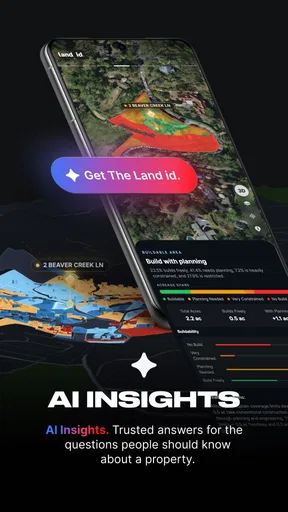
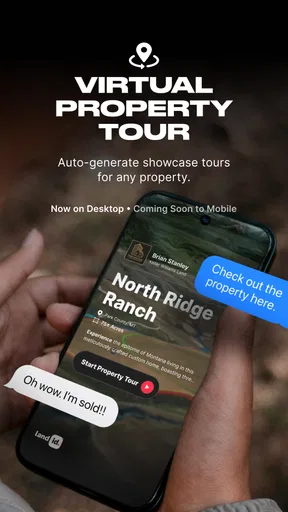
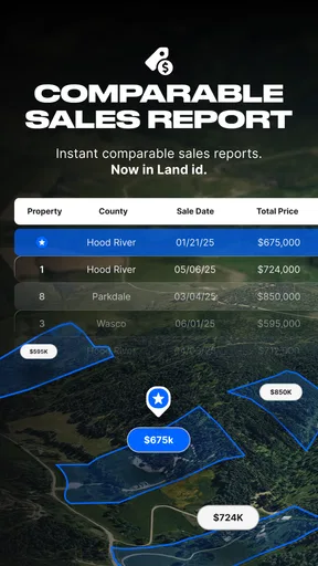
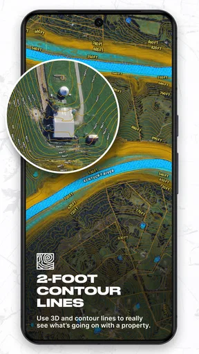
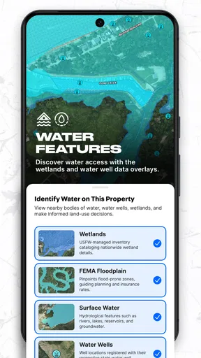
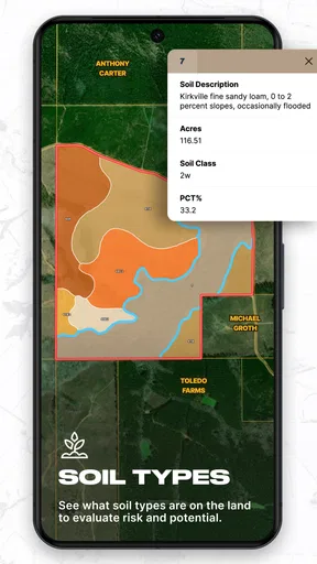
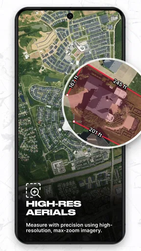
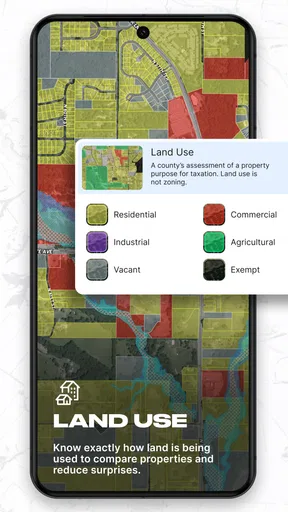
 Analysis by AppCompare
I find Land id® most useful when a map needs to answer a more specific question than “where am I?” A trail map can show a path, but land work often means checking where one parcel ends and another begins, or looking up ownership while standing near a boundary. That focus gives this productivity app a clear purpose, though it also means it is not a replacement for every kind of map or a substitute for formal property research.
What to plan before heading out
Connectivity is part of the experience to think about before leaving home. Looking at parcel information while you have a dependable connection is a sensible first step, especially if you expect to be in a rural area where loading map details may be less convenient. I would check the intended area in advance and avoid treating a phone screen as the only source of guidance once I am on unfamiliar land.
A practical workflow is to use the app at a desk first, then revisit the same location on site. At home, I can identify the parcel I want to investigate and note the questions I still need answered. Outdoors, I can focus on comparing the map with visible landmarks rather than trying to work out the whole property picture from scratch. This preparation makes a network-dependent tool more useful without assuming that every map or detail will be available in every situation.
Useful on foot, but not a boundary survey
The app is a natural fit for landowners, prospective buyers doing early research, and people whose outdoor plans involve property lines. It can also help a hiking or hunting trip stay oriented around parcel context. I would still keep ordinary navigation tools in mind: a route-focused map is usually better for trail conditions and turn-by-turn decisions, while Land id is more relevant when parcel boundaries and ownership are central to the question.
That distinction matters because a mapped boundary is helpful context, not permission to cross a line or proof of a legal boundary on the ground. If I were evaluating a purchase, I would use the app to narrow down questions and then confirm important details through appropriate records or a qualified professional. That is not a weakness unique to this app; it is a sensible limit for any phone-based parcel map.
When a field check gets complicated
GPS and map views can help me relate my position to the land around me, but the display should not be treated as survey equipment. Tree cover, terrain, and a small screen can make careful interpretation harder, and parcel edges may not be obvious in the landscape. I would zoom out to understand the surrounding parcels, then zoom in only when I need to inspect a particular area. Checking the map while stationary is also more comfortable than trying to interpret fine details while walking.
If a page or map detail takes time to load, I would first pause somewhere safe and check the connection rather than repeatedly tapping controls or assuming the boundary has changed. For a visit where network access is uncertain, I would plan a backup: note the location and relevant questions beforehand, and bring a separate navigation option suited to the terrain. That small bit of preparation is more useful than relying on an unverified assumption about offline access.
Worth Reading Before You Choose

EA SPORTS FC Mobile 26 Is a Bigger Football Game, but It Takes Time

Flipboard Shows What News Apps Must Do Beyond the Feed

Switching to Android Auto Means Rethinking Your Driving Routine

Google Calendar Makes a Crowded Week Easier to Manage

Ludo King Makes the Most of the Minutes Between Plans

Baby Panda World Brings Quick Play to Modern Phones, but Its Game Library Feels Busy
Who will get the most from it
Land id is most compelling when parcel information comes up often enough to justify a dedicated app: for example, a landowner checking neighboring parcels, a buyer screening several properties, or an outdoor user who wants to understand ownership before choosing where to go. Someone who only needs street directions or occasional trail guidance may find a standard maps app simpler. The value comes from the land-specific context, not from replacing all the tools already on a phone.
Before relying on it for repeated work, I would try a few familiar locations and see whether the parcel view answers the questions I actually have. That is a better test than judging it by how much information appears on screen. A useful map is one that helps me make a clearer next decision, whether that means contacting an owner, asking a seller for documents, or choosing a different route.
I've recently spent some quality time diving into the world of Land id®, and let me tell you, it's been quite the adventure. If you haven't heard of it yet, this app is like having a treasure map right in your pocket, and it's making waves for good reason. Let's break down why this app is gaining traction amongst outdoor enthusiasts and landowners alike.
Discovering the Features
First off, the app’s user interface is super intuitive. As soon as you fire it up, you're greeted with a clean map view, which is your gateway to discovering new lands. The app provides detailed property lines, ownership details, and even historical land data. It's like having a backstage pass to Mother Nature’s secrets.
Mapping and Navigation
One of the standout features of Land id® is its mapping capabilities. It’s powered by some of the most comprehensive geographic data out there. Navigating through different terrains is a breeze, and the app ensures you're never lost with its GPS tracking. Whether you're hiking, hunting, or just exploring, the app guides you with precision.
What's more, you can save your favorite spots and even plot routes for future adventures. Imagine having a personal guide that remembers where you’ve been and where you might want to go next. Pretty cool, right?
Data at Your Fingertips
If you’re someone who loves data, this app is going to be your new best friend. It offers an array of information about land ownership, which can be particularly handy for property buyers or land management professionals. With just a few taps, you can access detailed land reports and even historical ownership information.
This feature is especially useful if you’re considering purchasing a piece of land and want to do a little homework first. You can check out who owns what, how the land has been used over the years, and any potential land restrictions.
Offline Access
Another fantastic feature is the app's offline capability. We all know that connectivity can be sketchy in remote areas. Thankfully, Land id® allows you to download maps and data for offline use, ensuring you're never left in the lurch when you’re out in the wild. It’s like having a trusty old paper map, but way more interactive and detailed.
Who Can Benefit?
So, who exactly is this app for? Well, if you're into outdoor activities like hiking, camping, or hunting, you’ll find it incredibly useful. It's also a great tool for real estate professionals and landowners who need quick access to land data.
Moreover, environmentalists and researchers can leverage the app’s extensive data to study land use patterns and environmental changes. The possibilities are vast, and it’s exciting to see how this digital tool is bridging gaps in land information accessibility.
Getting Started
Getting started with the app is a cinch. Available on both Android and iOS, you can download it from the respective app stores. Setting up your account is straightforward, and once you're in, the app's user-friendly design ensures you won’t need a manual to find your way around.
The app comes with both free and premium options. While the free version offers plenty to get you started, the premium version unlocks a treasure trove of additional features and detailed data, making it a worthy investment for serious users.
Final Thoughts
All in all, Land id® is a remarkable app that combines the best of technology and nature. It’s like having a Swiss army knife for land exploration right on your phone. Whether you're an adventurer at heart, a real estate buff, or someone who simply loves data, this app is sure to impress.
In a world where information is king, Land id® reigns supreme by offering detailed, accessible, and reliable data right when you need it. So why not give it a try? You might just find your next great adventure is a tap away.
Pros
- User-friendly interface enhances navigation.
- Comprehensive mapping features available.
- Real-time data updates for accuracy.
- Customizable layers for specific needs.
- Offline access for remote locations.
Cons
- Limited free version functionality.
- Occasional performance lags on older devices.
- Requires significant storage space.
- Subscription can be costly for some users.
- Learning curve for advanced features.
FAQs for Land id®
What is the primary function of Land id®?
Land id® is designed to provide users with comprehensive mapping and property analysis tools. It allows users to identify land parcels, view property boundaries, and access detailed land data. This service is especially useful for real estate professionals, land developers, and anyone interested in land ownership details.
Is Land id® available on both Android and iOS platforms?
Yes, Land id® is available for download on both Android and iOS devices. Users can access the app through the Google Play Store for Android devices and the Apple App Store for iOS devices, ensuring a wide range of compatibility across different smartphones and tablets.
Does Land id® require a subscription or is it free to use?
Land id® offers both free and subscription-based services. While users can access basic features without a subscription, more advanced tools and detailed data sets typically require a paid subscription. This model allows users to choose a plan that best fits their needs and budget.
How accurate is the property data provided by Land id®?
Land id® sources its data from reliable public records and frequently updates its information to ensure accuracy. However, like any mapping service, there may be occasional discrepancies due to data updates or regional mapping issues. Users are encouraged to use this data as a reference and verify details with local authorities when necessary.
Can I share maps and property data from Land id® with others?
Yes, Land id® allows users to share maps and specific property data with others. This feature is particularly useful for real estate agents or land developers who need to collaborate with clients or colleagues. Users can typically share information via email or through direct links, depending on the app's sharing options.


